New files in: 1 day, 3 days, 7 days, 30 days
| Most downloaded for: all time,
year,
half a year,
month,
two weeks,
three days
Most popular by rating | Submit a file
Most popular by rating | Submit a file
| Folder: |
8h5 panel to IL-18D V2.1
| Rating: 5!
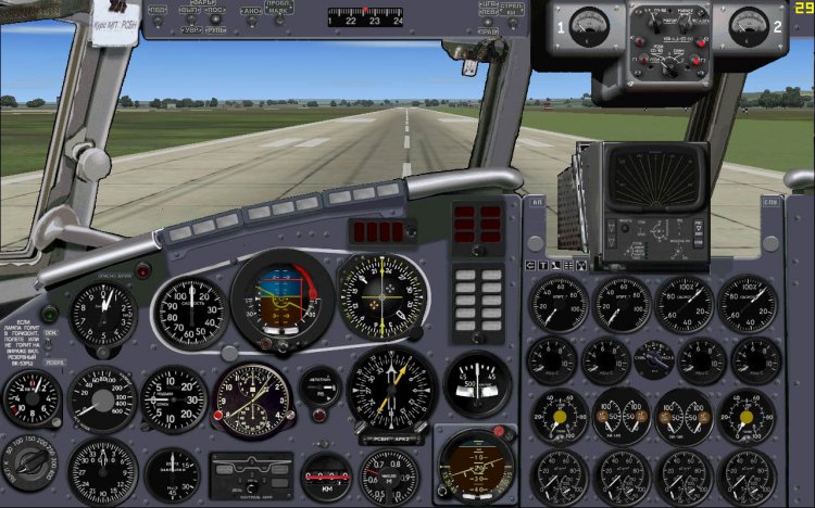
Altered to permit 1280h800 panel widescreen monitors for version 2.1. In the files of only bitmaps and side views. PS tried to catch all errors. If we will understand more.
→ Size:
7 MB
→ Date:
17 years ago (04.03.2009 04:17)
→ Author:
→ Approved by moderator:
AirArt
→ License:
Freeware - Free version, Unlimited Distribution
→ Downloaded:
1524 time(s)
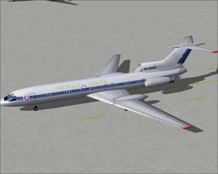
Panel 8x5 for Tu-134A
| Rating: 5!
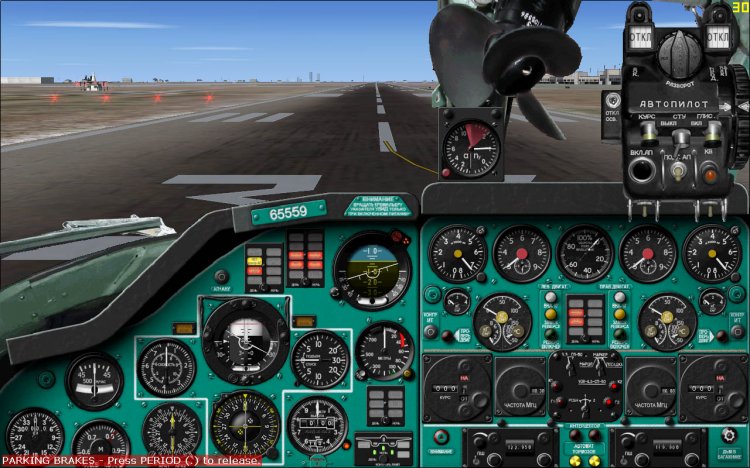
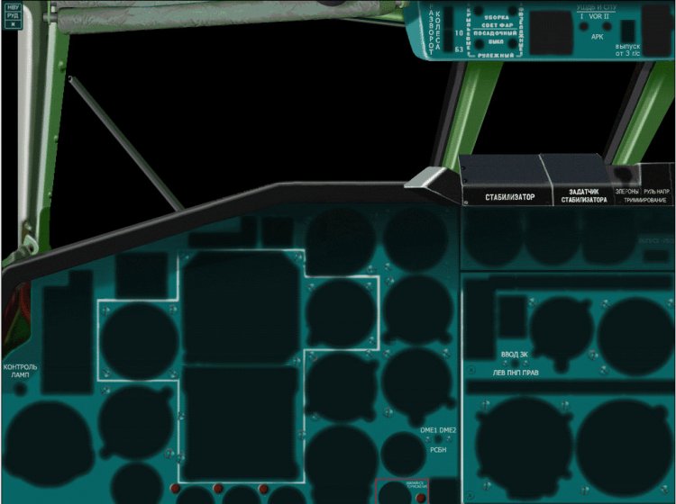
A slightly modified panel bitmaps KVS'a. Namely: added "janitor", and closed shutter. No additional pererisovok nebilo. You can feel free to substitute your bitmaps in my and all will be normal, or rather that your devices will not put them in the ground. Of course if you can not adjust to me, under the devices themselves;) does not shift.
→ Size:
204 KB
→ Date:
20 years ago (29.09.2005 01:00)
→ Author:
→ License:
Freeware - Free version, Unlimited Distribution
→ Downloaded:
253 time(s)
Map ETA Samara region
| Rating: 4!

Tried to make a map of OPV in the Samara region. To be honest, I even neznau how it looks in real and neznau how pravelny I have shown the road. But because there is a scenario airdromes Samara region, the sin was not done. True;)? This map is the fruit of my whole fantazii.Na it with absolute assurance pravelno identifies the distance and course. All the data I got from the simulator MSFS 2004. I hope you understand it, because the first time may seem incomprehensible. Sorry, did the first time such a thing. Unfortunately, for all of these airports, the Internet, I nenashel any scheme: (In addition to Bezymyanki:)
→ Size:
413 KB
→ Date:
21 years ago (09.05.2005 00:43)
→ Author:
→ License:
Freeware - Free version, Unlimited Distribution
→ Downloaded:
640 time(s)
In the files of only the basic textures, the rest need to take the existing ones. For a visual model of Samdim
→ Size:
475 KB
→ Date:
22 years ago (18.04.2004 18:24)
→ Author:
→ License:
Freeware - Free version, Unlimited Distribution
→ Downloaded:
1008 time(s)
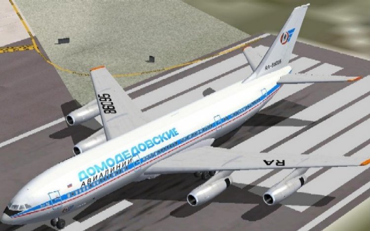
Repainting of the model of Samdim'a. In the files of only the basic textures, and the rest need to take the existing ones. Changed only the number.
→ Size:
623 KB
→ Date:
22 years ago (31.03.2004 15:26)
→ Author:
→ License:
Freeware - Free version, Unlimited Distribution
→ Downloaded:
1262 time(s)


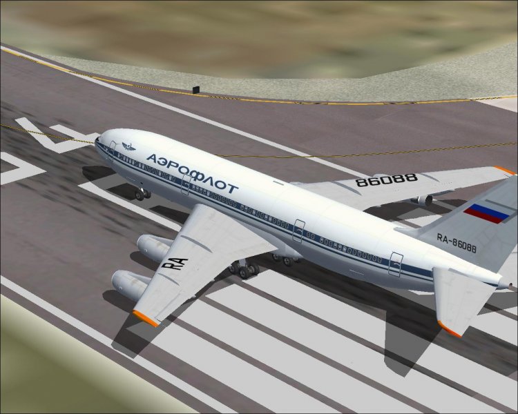
In this archive there are only texture and fuselage keel and revised schedule for the aircraft. The rest need to take the existing textures. For traffikovoy model of Samdim.
→ Size:
181 KB
→ Date:
22 years ago (02.02.2004 17:31)
→ Author:
→ License:
Freeware - Free version, Unlimited Distribution
→ Downloaded:
520 time(s)
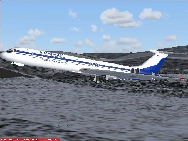
Slightly revised version of liveried "MAVIAL", namely, added the inscription - "The Governor Valentin Tsvetkov" -. Accidentally found this picture and decided to paint.
→ Size:
689 KB
→ Date:
22 years ago (02.02.2004 17:11)
→ Author:
→ License:
Freeware - Free version, Unlimited Distribution
→ Downloaded:
600 time(s)